Biking and Hiking New Zealand - 17 Stewart Island, Manapouri, Te Anau
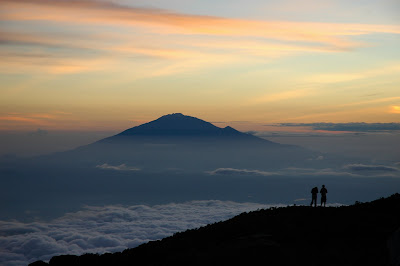
At 8:00 in the morning I was already at the bike dealer, even though he only opens at 8:30, but he had nothing for 9-speed components. So I went to another bike shop and bought what I needed at official Shimano prices, which was very expensive. My chain needed replacement after 5000 strenuous kilometers, new derailleur, new cassette, emergency drop out that I brought with me, but maybe a real replacement coming in from Christchurch on Tuesday, I will be off to Stewart Island until then and do the Rakiura track. I booked the Stewart Island ferry and a bus to Invercargill tomorrow at 10:00. Early to a motel. That was the northernmost point for departure, about 10 km on foot.
Invercargill
Invercargill is the southernmost and westernmost city in New Zealand, and one of the world’s southernmost cities. It is the main commercial centre of Southland, lying on the broad Southland Plains about 18 kilometres north of Bluff. The city is surrounded by fertile farmland and sits close to major natural attractions, including Fiordland, the Catlins, and the New River Estuary. Its Māori name, Waihōpai, comes from the Waihopai River, while its English name reflects Scottish influence: “Inver” from the Gaelic for a river mouth, and “Cargill” in honour of William Cargill. That Scottish heritage remains visible in the city’s street names, many of which are taken from rivers in Scotland, such as Dee, Tay, and Tweed.
European settlement developed in the mid-19th century, with Southland becoming a zone of early contact between Māori, whalers, missionaries, and later pastoral settlers. Invercargill itself was surveyed in the 1850s and grew alongside the development of Bluff as a port and the opening of the railway between the two in 1867, one of the earliest public railways in New Zealand. The city’s fortunes fluctuated in its early decades, especially when Southland briefly became a separate province before rejoining Otago, but dairying and export agriculture later gave the district a stronger economic foundation. Invercargill also played a notable role in social history: in 1884, the first all-women’s organisation in New Zealand was founded here, linked to the temperance and women’s suffrage movements.
The city is known for a character all its own. It has long summer twilights, occasional aurora australis, and a cool, often windy and cloudy oceanic climate that has helped give rise to the slogan “City of Water and Light.” Though rainfall is frequent, total precipitation is not especially high by New Zealand standards, and the city’s weather ranges from crisp frosts and occasional snow in winter to mild or sometimes surprisingly hot summer days. Queens Park, the historic water tower, the Civic Theatre, and wide gridded streets give Invercargill a spacious and rather distinctive appearance, while nearby Oreti Beach adds a strong coastal dimension to life in the city.
Modern Invercargill is a regional service centre with an economy built on agriculture, food processing, education, retail, and community investment. Population decline in the late 20th century was partly reversed through Southland’s dairy boom and the impact of the Southern Institute of Technology’s “Zero Fees” scheme, which brought students and new energy into the city. Invercargill is also unusual in New Zealand for its licensing trust system, under which alcohol sales and hospitality profits are channelled into community facilities and local projects. These trusts have helped fund major venues and sports infrastructure, contributing to the city’s strong civic culture.
Tourism has also become increasingly important. Invercargill sits on the Southern Scenic Route and serves as a gateway to Stewart Island, Fiordland, the Catlins, and southern Otago. Within the city, transport-themed attractions are especially prominent, including E Hayes and Sons with Burt Munro’s famous motorcycle, Bill Richardson Transport World, and Classic Motorcycle Mecca. The city is also home to Murihiku Marae, reflecting its continuing Māori presence, and to institutions such as SBS Bank, which traces its roots back to 19th-century Invercargill.
Sport and education are central to Invercargill’s identity. The city supports several professional and semi-professional teams, including the Southland Stags, Southern Steel, and Southland Sharks, and has major facilities such as Rugby Park, an indoor velodrome, and Stadium Southland. It is also remembered in music through the famous “Invercargill March,” dedicated to the city by composer Alex Lithgow. In education, the Southern Institute of Technology is the best-known institution, but the city also has a range of high schools and specialist training centres, including aviation. Altogether, Invercargill combines remoteness, practicality, and a strong sense of local pride, giving it a place in New Zealand quite unlike any other city.
At 8:00 in the morning I dropped off my bags at the campsite reception. In the rain I walked the 9 km back to the pickup point, where I had two coffees and a muffin and a nice conversation with the petrol station attendant opposite. Then by bus to Bluff. One-hour ferry to Stewart Island with very heavy seas. After buying the hut tickets in Oban, a three-hour walk to the hut — four hours if one starts from the car park, which is still 5–6 km away from Oban. At times the weather changed every minute: hail, sunshine, rain, wind. I met the Swedish couple again, and also Sina from Abel Tasman. The hut was looked after by Tom, an English warden of about 75 who called himself a dinosaur. If dinosaurs died out because of cold climates, Tom seemed determined to create a suitable habitat for them inside his hut. The fire in there was extremely hot...


Stewart Island
Stewart Island / Rakiura is New Zealand’s third-largest island and its southernmost inhabited one, lying across Foveaux Strait from the South Island. Roughly triangular in shape and deeply indented by bays and inlets such as Paterson Inlet and Port Pegasus, it is a landscape of hills, dense forest, and wild coastline, rising to nearly 1,000 metres at Mount Anglem / Hananui. More than 80 percent of the island is protected within Rakiura National Park, making it one of the most extensively conserved inhabited islands in the country. Its permanent population is very small, with most residents living in Oban on Halfmoon Bay, the island’s only main settlement.
The island has a long Māori history dating back to the 14th century. Its older Māori name, Te Punga o Te Waka a Māui, means “the anchor stone of Māui’s canoe,” linking it to the creation traditions in which the South Island is Māui’s canoe and the North Island the fish he pulled from the sea. The name Rakiura, now widely used alongside Stewart Island, is often translated as “glowing skies,” a reference to the aurora australis, though it also carries other traditional interpretations. The island’s dual official name reflects the wider recognition of Ngāi Tahu history and identity in southern New Zealand.
European knowledge of the island developed gradually. James Cook may have realised in 1770 that a strait separated it from the mainland, though he left the matter deliberately or inadvertently unclear. The waterway was later charted in the early 19th century, and the island took its English name from William W. Stewart, an officer who helped confirm its insular nature. Through the 19th century it was tied into New Zealand’s changing provincial system and later became part of Southland. In practice, however, Stewart Island remained remote and lightly settled, with fishing, small-scale trade, and later tourism shaping most of its European-era economy.
Stewart Island is especially important for its wildlife. Because it has remained sparsely populated and escaped many of the pressures that transformed the main islands, it retains large areas of native habitat and supports birdlife that is now rare elsewhere. Species such as weka, kākā, kererū, penguins, and the famous Stewart Island kiwi thrive here, while nearby predator-free islands such as Whenua Hou / Codfish Island protect critically endangered birds including kākāpō. The island has also become central to modern conservation efforts, though introduced pests such as cats, possums, rats, rabbits, and deer now pose serious threats. Plans for large-scale pest eradication reflect its national importance as a refuge for native species.
The island’s economy today rests mainly on fishing and tourism. Visitors come for tramping, birdwatching, dark skies, and the feeling of remoteness; in 2019 Stewart Island gained recognition as an International Dark Sky Sanctuary. Access is by ferry from Bluff or by small aircraft from Invercargill, and the crossing of Foveaux Strait has long had a reputation for rough seas. The ferry service has a long and colourful history, while air links now provide a quicker connection for passengers and supplies. Oban remains the practical hub for the island, though the wider landscape is what most people come to experience.
Despite its isolation, Stewart Island continues to adapt to modern needs while retaining a strong local identity. Electricity has long depended on diesel generation, though renewable energy projects, including planned solar development, aim to reduce costs and environmental impact. Mobile coverage and transport links have improved, but the island still feels markedly separate from mainland New Zealand. That sense of distinctiveness has even inspired humorous mock independence campaigns over the years. Altogether, Stewart Island / Rakiura is one of New Zealand’s most special places: a remote southern island where culture, wilderness, and conservation remain deeply intertwined.


Rakiura National Park
Rakiura National Park is New Zealand’s newest national park, opened in 2002 on Stewart Island / Rakiura. Covering about 85 percent of the island, it protects a vast area of forest, coastline, wetlands, and remote hill country, while excluding only Oban, some roads, and a few private or Māori-owned areas. The park was created from earlier reserves and state forest land, giving formal protection to one of the country’s wildest inhabited landscapes. At its entrance stands a chain sculpture symbolising the Māori tradition that Rakiura is the anchor stone of Māui’s canoe, linking the park closely to the island’s cultural as well as natural significance.
The park is especially important for wildlife and is one of the best places in New Zealand to experience native birds in a largely intact environment. Stewart Island’s lack of stoats and ferrets has allowed species such as the southern brown kiwi, or tokoeka, to remain unusually abundant, and the island is considered one of the finest places anywhere to see kiwi in the wild. Other birdlife includes kākā, while some coastal areas are breeding grounds for endangered yellow-eyed penguins. The wider Stewart Island area also played a major role in the conservation story of the kākāpō, which survived in the Tin Range before being moved to predator-free Whenua Hou / Codfish Island nearby.
The best-known walk in the park is the Rakiura Track, one of New Zealand’s Great Walks. It is a 32-kilometre circuit that usually takes three days and two nights, leading through lowland forest of kāmahi, tōtara, and rimu and along the shores of Paterson Inlet. The route includes places such as Port William and North Arm, combining bush, coastline, and historic sites in a relatively accessible format. One of its great attractions is the chance to hear or even see kiwi at night near the huts, something much harder to experience elsewhere in New Zealand.
For those wanting something longer and more remote, the park also contains the Northwest Circuit and the Southern Circuit. The Northwest Circuit is a much tougher 125-kilometre route around the island’s north and west, taking roughly eight to ten days and passing lonely beaches, Mason Bay, and the Freshwater Depression. The Southern Circuit, though shorter, is often more demanding, with mud, water, and a strong sense of isolation, leading as far as the remote Doughboy Bay Hut, the southernmost hut in the Department of Conservation network. Together these tracks make Rakiura National Park one of New Zealand’s great tramping destinations, ranging from a manageable Great Walk to some of the country’s wildest multi-day routes.


Port William and on to North Arm, about 4 hours. Rain the next day and a walk through the forest for 5 hours to North Arm Hut, where we had to take care of a fire for ourselves because, Maggie, the young marine archeologist did some work on the track and left for Oban in the afternoon by boat. Rain all day, but the hut was nice and warm with the wood stove.


Up at 6:00 and lit the fire again. Set off around 8:30. At midday in Oban. The weather was somewhat better but cold, after it had still been raining in the morning. The last day is a stroll along the coast and more forest and you may see a lot of birds that are not spotted easily anywhere else. The ride across Foveaux Strait can be very rough on the ferry. Just in time for the ferry and bus, then to the bike shop at 17:20. But the replacement parts will only arrive tomorrow by courier, apparently. Walked out to the campsite and tomorrow I will have to walk back into town again — not exactly a small distance. On the way I bought a bottle of white wine, lamb chops, kumara, and potato chips. Not bad. I had just set up my tent reasonably dry when the rain started again.


Birds in the South of New Zealan
Southern brown kiwi / tokoeka
The southern brown kiwi, or tokoeka, is one of New Zealand’s kiwi species and is native to the South Island and Stewart Island / Rakiura. Though once grouped together with the North Island brown kiwi, it is now generally treated as a separate species. It is a medium-sized, flightless bird with shaggy, rufous-brown plumage, a long slender bill, and powerful legs, and like all kiwi it belongs to the ancient ratite lineage. Its anatomy is highly specialised for life on the forest floor, with reduced wings, no tail in the usual sense, and whisker-like feathers around the bill.
Tokoeka rely more on smell than sight when foraging, using nostrils placed near the tip of the bill to detect prey in the soil. They feed mostly on invertebrates such as worms, beetle larvae, spiders, centipedes, and snails, but also take other small animals when available. They are nocturnal and highly territorial, often communicating with loud calls and duets: the male gives a shrill whistle, while the female answers with a deeper, harsher note. Their voices are one of the characteristic night sounds of southern New Zealand forests.
The species is usually divided into Fiordland tokoeka and Stewart Island tokoeka, with the rare Haast birds often treated as a separate form because of their distinct plumage and tiny population. Stewart Island is especially important for the species, because kiwi remain relatively common there compared with most of mainland New Zealand. That is one reason the island is famous as one of the best places in the country to see kiwi in the wild. On the mainland, populations in Fiordland and around Haast have had a much more difficult history.
Southern brown kiwi are monogamous and nest in burrows or sheltered places under dense vegetation. Usually the female lays one egg, occasionally two, and the male does most of the incubation, which lasts about three months. The chick hatches well developed and leaves the nest after only a few days, feeding for itself, though it may stay around its parents for some time. Despite this resilience, the species has declined because eggs, chicks, and even adults are vulnerable to introduced predators such as stoats, cats, dogs, ferrets, and possums. Stewart Island populations have remained comparatively stable largely because some of the worst predators have long been absent or less widespread there.
Weka
The weka is a large, flightless rail endemic to New Zealand, often described as about the size of a chicken but much more curious and assertive. It has rich brown plumage mottled with darker tones, sturdy legs, a strong reddish bill, and a constantly flicking tail that gives it a restless, alert appearance. Although often called the “Māori hen” or woodhen, it is in fact a rail, related to other wetland and ground-living birds. Several regional forms have been described, though modern genetics supports fewer clear divisions than older classifications suggested.
Weka are highly adaptable birds and occupy a wide range of habitats, from forest and subalpine grassland to dunes, rocky coasts, and even modified semi-urban areas. They are omnivorous, feeding on invertebrates, fruit, seeds, leaves, carrion, and occasionally small animals or birds. On Stewart Island, they have even been recorded preying on sooty shearwater eggs and chicks. Their bold curiosity often brings them close to campsites and houses, where they are notorious for investigating, carrying off, or stealing small loose objects—especially shiny ones.
Breeding can occur over a long season and, when food is abundant, weka may raise several broods in a year. Their nests are made on the ground in dense cover, and both sexes share incubation and care of the chicks. This flexibility helps explain why weka can be productive in favourable conditions, yet their populations have still disappeared from large parts of their former range. They remain common in some places but absent from many others, showing both their adaptability and their vulnerability.
Weka are classed as vulnerable, and their conservation is unusually complicated. Some populations are threatened by predators such as dogs, cats, stoats, ferrets, and rats, while eggs and chicks are also exposed to disease, habitat loss, poisoning, and roadkill. At the same time, weka themselves can create problems for conservation when introduced to islands where they prey on more fragile native wildlife. For Māori, however, weka have long had cultural significance, admired for their boldness and once used for food, feathers, perfume, and other practical purposes. Few native birds combine such charisma, nuisance value, and cultural importance in quite the same way.
New Zealand kākā
The New Zealand kākā is a large forest parrot of the genus *Nestor*, closely related to the alpine kea and more distantly to the kākāpō. It is a medium-sized, strongly built parrot with brownish plumage washed with olive, grey, red, and orange, and with brilliant flashes of scarlet and orange under the wings. Two regional forms, from the North and South Islands, have traditionally been recognised, though the differences are slight. Its calls are loud and distinctive, ranging from harsh “ka-aa” cries to more musical whistles, and it is one of the characteristic voices of native New Zealand forest.
Kākā are mainly arboreal, spending much of their time in the mid and upper canopy of mature forest, where they feed on fruit, seeds, flowers, nectar, honeydew, sap, and invertebrates. They are especially known for peeling bark to reach tree sap or digging larvae from wood with their powerful bills. Their brush-tipped tongues help them exploit nectar and honeydew, while their feet are used with typical parrot dexterity to manipulate food. They are also highly social and intelligent birds, with juveniles engaging in elaborate play behaviour such as chasing, wrestling, and play invitations, all of which point to sophisticated cognition and social learning.
The species nests in hollows in large trees, where the female incubates the eggs while the male feeds her. This breeding strategy makes kākā especially vulnerable to introduced predators, because the female spends long periods confined to the nest and chicks remain in cavities for weeks. Historically kākā were widespread across New Zealand, but habitat loss, predation by stoats, cats, possums, and rats, and competition with wasps and bees for honeydew have greatly reduced their range. Even so, they remain reasonably easy to find in some South Island forests, including parts of Fiordland and Stewart Island, and can also be seen on offshore islands such as Ulva Island and Whenua Hou.
Kākā are also a taonga species in Māori culture and have gained new public visibility through urban conservation success stories, most famously in Wellington, where reintroductions have allowed them to recolonise the city. Their return has delighted many people, though it has also led to conflicts when birds damage trees, roofs, or outdoor furniture. Conservation efforts such as predator control have shown that kākā populations can recover significantly when conditions improve. As a result, the species has become not just a symbol of native forest life but also of the possibilities—and complications—of restoring wildlife in modern New Zealand.
Kākāpō
The kākāpō is one of the most extraordinary birds in the world: a giant, nocturnal, flightless parrot found only in New Zealand. Moss-green and yellow, with soft owl-like facial feathers, a large pale bill, and a sweet musky scent, it combines features unlike those of any other parrot. It is the world’s heaviest parrot, entirely herbivorous, and the only parrot known to breed through a lek system, in which males gather and boom to attract females. Its anatomy reflects life on predator-free islands: short wings, reduced flight muscles, strong legs, and a body built for climbing rather than flying.
Historically the kākāpō lived across much of New Zealand in many habitats, from forests to scrub and subalpine areas. It is mainly nocturnal, feeds on leaves, shoots, fruits, seeds, and other plant material, and leaves distinctive fibrous feeding remains behind. Despite being unable to fly, it climbs trees well and can glide or parachute down from heights. Its behaviour evolved in a world where the main predators were birds of prey; when threatened, it would freeze and rely on camouflage, a strategy that failed disastrously once humans introduced mammalian predators such as dogs, cats, stoats, and rats.
The species declined catastrophically after human arrival. Māori hunted it and brought kiore, while European settlement brought habitat destruction, more predators, and widespread collecting for museums and zoos. By the 20th century the kākāpō had vanished from most of its range, and for a time it seemed close to extinction. The discovery of a surviving population on Stewart Island in the 1970s, including females, was therefore critical. Even there, however, feral cats were killing birds at unsustainable rates, leading to the transfer of the remaining kākāpō to predator-free islands.
Modern recovery of the kākāpō is one of New Zealand’s great conservation stories. Intensive management, supplementary feeding, genetic monitoring, predator-free island sanctuaries, and close care of every known bird have raised the population from the brink, though the species remains critically endangered. Every individual is known by name, monitored, and of immense importance to the recovery effort. Stewart Island was central to that story because it provided the last crucial refuge from which the modern population could be saved. Today, the kākāpō stands not only as one of the rarest birds on Earth, but also as a symbol of how determined conservation can rescue a species that once seemed doomed.


An Austrian couple whom I got to know yesterday evening took me to the bike shop by car. At 10:00 the courier from Christchurch arrived. The replacement part fit, and by 11:00 I was back on the bike. A very nice café stop in Riverton, oldest settlement in Southland (about 175 years old). I took a hostel in Tuatapere because the rain was very heavy and continuous. Enough space for all: the Austrian family caught up with me in their car.

Riverton
Riverton / Aparima is a small coastal town in Southland, about 30 kilometres west of Invercargill, set beside the Jacobs River Estuary where the Aparima and Pourakino rivers meet before flowing into Foveaux Strait. The town stretches across both low-lying plains and the hills of South Riverton, with views over estuary, beach, and sea. It is one of the oldest towns in New Zealand and the oldest permanent settlement in Southland, giving it a special place in the history of the far south. Today it is reached by the Southern Scenic Route and is known for its relaxed coastal atmosphere, safe harbour, and strong connection to both land and water.
The area was known to Māori as Aparima, and later became an early centre of contact between Māori and European whalers. In the 1830s Captain John Howell established a whaling station here, and the settlement became known as Jacob’s River before officially adopting the name Riverton in 1858. The town’s history reflects the wider transition of southern New Zealand from sealing and shore whaling to farming and permanent settlement. By the mid-19th century, as whaling declined, local people increasingly turned to the land, and Riverton developed into a small service and transport centre, later strengthened by coach services and then by the arrival of the railway in 1879.
Modern Riverton’s economy has long centred on fishing, though farming and rural support industries have become increasingly important as the fishing sector declined. Its harbour remains active and valued, both as a practical access point to the southwest seas and as a place for recreation such as rowing, fishing, water skiing, and flounder gathering. Taramea Bay and nearby beaches make it a popular summer destination for Southlanders, while the wider area is also known for dolphin sightings and for surfing, especially around Mitchell’s Bay and nearby Colac Bay. Historic buildings, the Te Hikoi heritage centre, and the town’s marae add cultural depth to what is otherwise an easygoing seaside settlement with a strong sense of place.


This morning it was not raining, but neither was it all sunshine, and there were many rain clouds on the horizon. It did rain again, but not on the last 30 km from the Eglinton Valley before Manapouri. Gradually the clouds cleared.
I stayed in Manapouri back in 2011, this time just passing by, but its worth a stay and a excursion to Doubtful Sound.
At 14:00 in Te Anau I booked two campsites on the Kepler Track. Shopping, organise the shuttle for Saturday back, organise a place for the bike until Saturday. The holiday park there, because the next one to the Kepler Track was 1.5 km away. At 15:00 on the track, at 17:20 in Brod Bay, bathing in the lake — well, briefly in.


Manapouri and Lake Manapouri
Manapouri is a small settlement in the far southwest of New Zealand’s South Island, on the eastern shore of Lake Manapouri at the edge of Fiordland National Park. Though small, it occupies a remarkable position: it is the westernmost municipality in the country and serves as one of the main gateways into the remote landscapes of Fiordland. Just a short drive from Te Anau, the township is a base for boat trips, walking tracks, and journeys onward to Doubtful Sound and Dusky Sound. In summer especially, it becomes a busy but still quiet-feeling stopping point for travellers heading deeper into the southwest.
The town itself remains modest in size, with only a few hundred residents and a small collection of visitor services such as cafés, accommodation, a garage, shops, and boat departures from Pearl Harbour. It is also known for local attractions ranging from short walks and kayaking to the little bookshops made famous by Ruth Shaw’s memoir. Nearby cycle routes and lake excursions make it a centre for low-key outdoor recreation rather than urban activity. Manapouri also has a place in popular culture, having served as a filming location for Peter Jackson’s The Lord of the Rings, with several nearby Fiordland landscapes used for scenes in the trilogy.
Lake Manapouri itself is one of New Zealand’s great natural landmarks, often described as the country’s most beautiful lake. Formed by glaciation, it is New Zealand’s second-deepest lake, reaching 444 metres, and because its basin lies far below sea level, the bottom sits some 267 metres beneath the ocean’s surface. The lake has four main arms—North, South, West, and Hope—along with smaller bays, and it contains 33 islands, many of them forested. Surrounded by the Kepler Mountains, Hunter Mountains, and other ranges, it lies within Fiordland National Park and the wider Te Wāhipounamu World Heritage Area.
The lake also has a rich Māori history and mythology. According to tradition, it was formed from the tears of two sisters, Moturua and Koronae, giving rise to the interpretation of Manapouri as meaning an anxious or sorrowful heart. Earlier names may have referred to rain or to the lake’s many islands, and Māori long valued the area for food such as birds and eels. European explorers first recorded the lake in 1852, but its deeper meaning in the landscape long predates that moment. Even today the many islands, inlets, beaches, and dark forested shores give it a feeling of age and legend that few lakes can match.
Ecologically, Lake Manapouri is notable for its exceptionally clear, nutrient-poor water and its largely unspoiled character, especially on the western and northern shores. It supports native fish and eel populations and contains many islands whose vegetation has escaped the browsing damage caused by red deer elsewhere in Fiordland. In particular, some of the smaller islands retain remarkably intact forest understorey and mossy ground layers. The lake’s beaches, shorelines, and islands have been closely studied because they reveal both long-term natural processes and the effects of changing water levels on forest, sediment, and habitat.
Lake Manapouri is also central to one of New Zealand’s most famous environmental struggles. In the 1960s and early 1970s, plans to raise the lake for hydroelectric generation at the Manapouri Power Station sparked the Save Manapouri campaign, widely regarded as the country’s first great environmental movement. The campaign succeeded, the lake was not raised, and the Guardians of Lake Manapouri and Te Anau were established to help oversee lake management. The power station still operates, diverting water westward through underground tunnels to Deep Cove in Doubtful Sound, but lake levels are now managed close to their natural range. This balance between energy generation and environmental protection has made Manapouri not only a place of great beauty, but also one of lasting significance in New Zealand’s conservation history.