Biking and Hiking New Zealand - 16 Otago Central Rail Trail to Invercargill
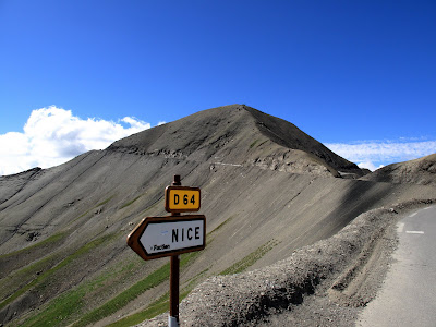
Otago is not as green as most of New Zealand; in places the landscape has something almost Burren-like about it, though its wines can be much richer. The Otago Central Rail Trail follows the old railway formation, so you ride over viaducts and through tunnels much as the train once did. I did it slowly, or at least slower than my final timing suggested, and spent nearly a full day on that 150 km gravel route, even though most people spread it over four days. Middlemarch: dead as a doornail, nothing going on. No grocery store; the dairy had nothing suitable to pour over my pasta. The ice cream there was good, though, and I got a large portion for $2.50.


Otago Central Rail Trail
The Otago Central Rail Trail is a 150-kilometre walking, cycling, and horse-riding route in New Zealand’s South Island, following the former Otago Central Railway between Middlemarch and Clyde. One of the country’s pioneering rail-trail projects, it helped inspire the wider New Zealand Cycle Trail network and later became part of it. Since opening, the trail has grown into one of Central Otago’s major attractions and a significant economic asset for the small towns and rural communities along its course.
The route arcs through Strath Taieri and the Maniototo, crossing open high-country landscapes and passing through small settlements that once depended on the railway. Because it follows a former rail line, the gradients are generally gentle and the riding or walking is considered relatively easy, though the distances still require planning. Along the way, users pass through tunnels, over large viaducts such as the Poolburn Viaduct, and across some of the South Island’s most distinctive inland scenery. To fully enjoy both the engineering heritage and the landscape, most people allow several days to complete it.
The trail’s popularity has transformed the region, encouraging the growth of accommodation, shuttle services, bike hire, and luggage transport, and even earning it the nickname the “Ale Trail” because of the number of pubs along the route. At the same time, it still passes through sparsely settled country where riders and walkers need to be reasonably self-sufficient. The area’s continental climate can also be demanding, with hot summer days, freezing winters, and strong winds that can make progress slow. Even so, the Otago Central Rail Trail remains one of New Zealand’s classic cycle journeys, valued as much for its history and atmosphere as for the ride itself.


Otago
Otago is a large and varied region in the southern half of New Zealand’s South Island, covering about 32,000 square kilometres and centred on Dunedin, its principal city. The name comes from the southern Māori pronunciation of Ōtākou, a Māori settlement near the entrance to Otago Harbour. Today the region includes major urban centres such as Dunedin, Oamaru, Alexandra, and Balclutha, as well as internationally known tourist destinations like Queenstown and Wānaka. With its mixture of cities, high country, coast, and mountain landscapes, Otago is one of New Zealand’s most diverse regions both geographically and economically.
The region has deep Māori roots, with early settlement focused mainly on the coast, especially around the Otago Peninsula. European settlement began in earnest in 1848, when Scottish immigrants associated with the Free Church of Scotland arrived to found Dunedin and the Otago settlement. That Scottish influence left a lasting mark on the region’s character, but it was transformed in the 1860s by the Otago gold rush, which brought a surge of migrants from around the world, including many from Australia, Europe, North America, and China. For a time, Otago became New Zealand’s economic and cultural centre, and institutions such as the University of Otago, founded in 1869, date from this period of rapid growth and ambition.
Otago’s landscapes are unusually varied. In the west lie alpine mountains, glaciers, and large lakes such as Wakatipu, Wānaka, and Hāwea, while the Clutha / Mata-Au and Taieri rivers shape much of the region’s interior and lowlands. Central Otago is known for its dry basins, schist mountains, tussock grasslands, and climate extremes, with hot summers and cold frosty winters that come closer to a continental climate than almost anywhere else in New Zealand. By contrast, the coast has milder and wetter conditions, while the southeast includes the rugged hill country of the Catlins. These contrasts have helped shape everything from settlement patterns to farming and transport routes.
Modern Otago has a mixed economy built on tourism, agriculture, hydroelectric power, education, and wine. Dunedin remains an important urban and academic centre, while rural districts support farming, dairying, and orchards. Central Otago has become especially well known for vineyards, particularly Pinot noir, and Queenstown and Wānaka have driven rapid growth through tourism and outdoor recreation. With a population of over 250,000, Otago today combines strong regional identities—Scottish, Māori, rural, alpine, and urban—into one of New Zealand’s most distinctive and influential regions.


In Middlemarch I met a Swiss couple who had already been cycling around the world for four years — not just on the Otago Rail Trail. I set off at 7:30 and had breakfast at McPies. After three not-so-small hills I decided to skip Dunedin and continue instead toward Milton, Balclutha, Kaka Point, and Nugget Point. The weather was warm and dry. There was wind, mostly in my face, but at least it was a warmer wind.


Milton
Milton is a small town in South Otago, about 50 kilometres south of Dunedin on State Highway 1, with a population of just over 2,000. Formerly known as Tokomairiro, it lies on the floodplain of the Tokomairaro River, whose branches curve around the town and lend their name to several local institutions. Founded in the 1850s as a milling settlement, Milton grew quickly during the Otago gold rush because it stood on one of the main routes inland to the goldfields around Lawrence. For a time it was a major staging post for miners and travellers, and in early Otago it was a more important centre than its size today might suggest.
The town’s development was shaped by transport, industry, and education. Its landmark building is the striking Tokomairiro Presbyterian Church, designed by R. A. Lawson, whose gothic spire still dominates the surrounding plain. Milton was an early railway town on the Main South Line and later became a junction for the Roxburgh Branch, reinforcing its role as a communications and service centre. It was also known for industries such as the Bruce Woollen Mills, coal mining in the nearby Tokomairaro valley, and a significant pottery industry that produced bricks, tiles, ceramics, and domestic wares in the late 19th century. The town also played an early role in education and communications, including one of New Zealand’s first long-distance telephone links with Dunedin.
Today Milton functions mainly as a service town for the surrounding farming district, with forestry and construction also contributing to the local economy. Its layout still reflects its historical development, with the main street, Union Street, forming the spine of the settlement and the old village of Fairfax now known as Tokoiti nearby. Milton is also locally famous for the curious “kink” in Union Street, where the otherwise straight highway suddenly shifts sideways for one block, a quirk whose true origin remains disputed. Though now quieter than in its gold rush and railway heyday, Milton retains a strong sense of history and remains one of South Otago’s key small towns.


Nugget Point Lighthouse
Nugget Point Lighthouse stands on one of the most dramatic headlands on the Otago coast of New Zealand’s South Island, overlooking the jagged rock islets known as “The Nuggets.” Owned and operated by Maritime New Zealand, it has long been an important coastal beacon in a wild and exposed stretch of shoreline. A short walking track from the nearby car park leads visitors to a viewing platform beside the lighthouse, from where there are wide views over the ocean and the rocky outcrops below.
The lighthouse was built between 1869 and 1870 and first lit on 4 July 1870. Its tower was made from locally quarried stone, while the original lighting apparatus had arrived in New Zealand years earlier with lighthouse designer James Balfour and had initially been intended for Cape Saunders. Because of delays there, the equipment was instead installed at Nugget Point. Over time, the lighthouse evolved from an oil burner to an electric lamp powered first by a diesel generator, later by the mains grid, while still retaining its original lens for many years.
In the modern era, Nugget Point Lighthouse has been fully automated and remotely managed from Wellington. The original light was eventually replaced by an LED beacon, and in 2020 the station was converted to solar power, ending its reliance on the mains. Though no longer staffed, the lighthouse remains both a functional aid to navigation and one of Otago’s best-known coastal landmarks, valued for its history as much as for its spectacular setting.


About 20 km after Owaka, climbing uphill, I hit a section of roadworks: sticky tar on the road with loose small gravel on top. The gravel stuck to the tyres, was thrown onto the chain, jammed in the derailleur, and under strong uphill load the derailleur went straight into the spokes. That rear wheel, built by myself, turned out to be stronger than the derailleur and stronger than the dropout. Fifteen minutes later I had converted the bike into a singlespeed and then cycled and pushed over the hills along the coast for another 130 km to Invercargill. I chose a middle gear that let me ride at something between 12 and 24 km/h. Today: 162 km in 9 hours 15 minutes. At the campsite in Invercargill I booked two nights. Tomorrow I’ll go to the bike shop. The accident kept me from sightseeing and from taking many pictures.


Catlins
The Catlins is a rugged and sparsely populated region in the far southeast of New Zealand’s South Island, stretching between Balclutha and Invercargill across parts of Otago and Southland. It includes some of the country’s most dramatic coastal scenery, from steep cliffs and wild beaches to blowholes, waterfalls, and the famous petrified forest at Curio Bay. Inland, the landscape rises into bush-covered hills and valleys carved by rivers such as the Ōwaka, Catlins, and Tahakopa. The region also contains Slope Point, the South Island’s southernmost point, and is known for its exposed location, heavy swells, and often wild weather.
The Catlins is especially valued for its natural environment. It contains the largest remaining area of native forest on the South Island’s east coast, much of it protected within Catlins Conservation Park, with podocarps, beech forest, and rich undergrowth thriving in the moist maritime climate. The coast and forests support a remarkable range of wildlife, including yellow-eyed penguins, fur seals, Hooker’s sea lions, Hector’s dolphins, seabirds, and native forest birds, while whales may be seen offshore in season. This combination of dense temperate rainforest and rich marine life makes the Catlins one of New Zealand’s most important ecotourism destinations.
People have lived in the Catlins since around the 14th century, with Māori communities using the area’s river mouths, forests, and coastline as seasonal food-gathering grounds. European contact began with explorers, sealers, and whalers, and in the 19th century the region developed around timber extraction, shipping, and later farming. The Catlins takes its name from the Catlins River, itself named after whaling captain Edward Cattlin. Its dangerous coastline became notorious for shipwrecks, including the tragic loss of the Tararua in 1881, and lighthouses at Nugget Point and Waipapa Point were built to help protect shipping. As the sawmilling era declined, farming, especially sheep and dairy, became the mainstay of the local economy.
In modern times tourism has become increasingly important alongside farming and fishing. Visitors come for natural attractions such as Purakaunui Falls, Cathedral Caves, Curio Bay, and the region’s remote, atmospheric scenery. The Southern Scenic Route threads through the district, connecting its scattered settlements, the largest of which is Owaka. Although the population has fallen greatly from its early 20th-century peak, the Catlins retains a strong local identity shaped by isolation, resilience, and closeness to nature. It remains one of New Zealand’s most distinctive regions: remote, windswept, and rich in both history and wildlife.
The Catlins also has a deeper geological and cultural significance. Its hill ranges are part of the ancient Murihiku terrane, with rocks dating back more than 150 million years, and Curio Bay preserves the fossil remains of a Jurassic forest. In literature and the arts, the region has inspired writers and filmmakers, perhaps because of its combination of solitude, weather, and raw beauty. Today, despite its small population and limited services, the Catlins continues to attract people seeking a more remote side of New Zealand—one where forests meet the sea, wildlife remains abundant, and the land still feels both ancient and untamed.